


THE ACCOBAMS SURVEY INITIATIVE DATA
The ACCOBAMS Survey Initiative (ASI) project aims to establish an integrated, collaborative and coordinated monitoring system for the status of cetacean populations at the whole ACCOBAMS area level, with the final aim to strengthen the conservation efforts and governance for cetacean species. Implemented by the ACCOBAMS Permanent Secretariat, in coordination and with the support of riparian countries and local scientists, the ASI led in 2018 and 2019 to collect an unprecedent amount of data on marine wildlife (cetaceans and other marine megafauna species) and anthropic pressures thanks to regional surveys conducted throughout the Mediterranean and the Black Sea.
In the Mediterranean Sea, monitoring efforts were conducted through:
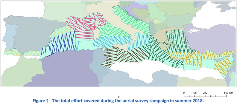
- Aerial surveys in more than 75 % of the region (include a map of transects below)
- Boat-based visual surveys in coastal Egyptian, Lebanese and Syrian waters
- Boat-based visual and Passive Acoustic Monitoring surveys with the Research Vessel Song of the Whale (Marine Conservation Research) in the Western basin of the Mediterranean, the Hellenic Trench and the waters off shore of Libya (INCLUDE a MAP of transects below)

In the Black Sea, monitoring efforts were conducted through:
1. Aerial surveys over Bulgarian, Georgian, Romanian, Turkish and Ukrainian waters through the CeNoBS project (Support Marine Strategy Framework Directive implementation in the Black Sea through establishing a regional monitoring system of cetaceans (D1) and noise monitoring (D11) for achieving Good Environmental Status ) CeNOBS
2. Aerial Survey over Russian Waters conducted through a collaboration with EU-UNDP EMBLAS + project
During those efforts, data was collected on Cetaceans, megafauna species (sea turtles, elasmobranches, fish, birds), smaller species (plankton, jellyfish), human activities and pressures (marine liter, shipping activities, fishing activities).
The data collected under the ASI is made available for the widest possible use for conservation related purposes, in accordance to Terms of use developed by ACCOBAMS
Data accessible here contain Metadata files (in excel and shapefile format):
– all data collected for each type of survey: including maps of blocks and transects
– datasets of sightings and acoustic data: observations, taxon, number of individuals, geographical coordinates, blocks, etc.
The Survey effort information associated with the ASI datasets is not accessible here. In case of interest for this additional information, please contact directly the ACCOBAMS Secretariat (secretariat@accobams.net).